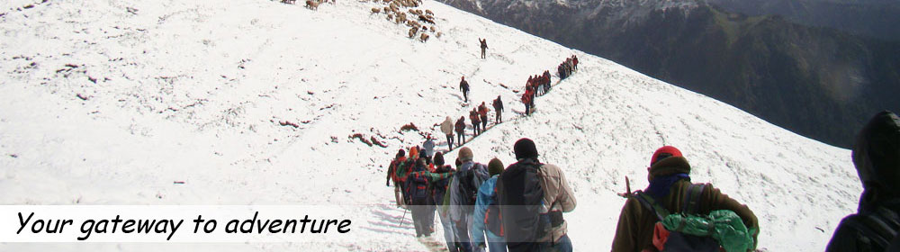

Safety on Treks
Mountain Sickness Himalayan Weather Terrain
Mountain Sickness
Some Fact about High Altitude Sickness:
Some Fact about High Altitude sickness Generally Trekkers comes for high altitude Himalayan treks and they are not aware about altitude sickness. Trek the Himalayas has collected some information and our experience to share about altitude sickness to help Himalayan trekkers. Altitude sickness generally refers to a condition known as Acute Mountain sickness (AMS). It affects people in areas of high altitude, which means areas at around 2,500m above sea level. Altitude sickness is more common, and becomes more severe, with increasing altitude.
About altitude sickness:
If you ascend to an area of high altitude, you are likely to experience some form of altitude sickness. Usually, the symptoms are mild and will improve if you descend.
Altitude sickness is most likely to affect you if you ascend quickly – especially at a rate of more than 500m per day – or if you don't allow yourself time to get used to the height (acclimatise).
Acute mountain sickness (AMS) is the most common and mildest form of altitude sickness. If you go on a climbing expedition or stay in an area of high altitude, you may develop AMS. High-altitude pulmonary oedema (HAPE) and high-altitude cerebral oedema (HACE) are much more severe forms of altitude sickness. They usually affect you only if you are at very high or extreme altitude.
What counts as high altitude?
- High altitude refers to heights that are between 1,500 and 3,500m above sea level.
- Very high altitude is from 3,500 to 5,500m above sea level.
- Extreme altitude is from 5,500 to 7,500m above sea level.
Symptoms of altitude sickness
You may notice symptoms of altitude sickness about six to 24 hours after you've arrived at an area of high altitude. However, this varies from person to person and will depend on the speed of your ascent. If you've been climbing or ascending slowly, the onset of your symptoms will be more gradual.
If you have altitude sickness in its mildest form (AMS), you may:
- Have a headache
- feel tired
- feel sick or vomit
- lose your appetite
- feel dizzy
- have difficulty sleeping
Symptoms of AMS usually start to ease within about two days as your body acclimatises to the high altitude, particularly if you don't ascend any further. If your symptoms get worse, the best thing you can do is descend as quickly as possible. There are some medications that can help ease your symptoms and treat complications, but only descending will deal with the cause.
Complications of altitude sickness
If you ascend to an area of high altitude too quickly and don't allow your body time to acclimatise, you may develop a serious form of altitude sickness such as HAPE or HACE. These conditions are rare, but potentially fatal if you don't descend immediately and receive treatment.
HAPE occurs when fluid builds up in your lungs. Symptoms usually develop between two and four days after a rapid ascent over 2,500m. You may:
- Have a dry cough
- Feel breathless at rest
- Have a fever
- Feel confused
- Have pink or bloody spit
- Have a bluish tinge to your skin, lips and nails (cyanosis)
HAPE can occur by itself or in conjunction with HACE. HACE occurs when excessive fluid collects in your brain, causing it to swell. Fewer than two percent of people with altitude sickness develop HACE and it rarely occurs below 4,000m. If you have HACE you may:
- Have a severe headache
- Feel very confused
- Lose co-ordination
- Have blurred or double vision
- Notice changes in your behaviour - for example, you may feel irritable or be unhelpful
- Lose consciousness
- Hallucinate (see, hear, feel and smell odd things that aren't really there)
- Fall into a coma (this is rare)
The symptoms of HACE may progress rapidly from mild to life-threatening within a few hours. If you have these symptoms, you should descend to a lower altitude as soon as possible and seek urgent medical advice.
You may develop other symptoms at high altitude. For example, your face, arms or legs may swell up (peripheral oedema). This usually lasts a few days and then disappears. At altitudes of 5,000m and over, tiny blood blisters can form at the back of your eye (retinal haemorrhages), but you may not notice any symptoms and they only occasionally interfere with your vision.
Causes of altitude sickness
At high altitudes, the air is at a lower pressure than it is nearer sea level. This makes it harder to get oxygen out of the air you breathe in, and into your bloodstream. Your body responds by increasing your breathing and heart rate.
There are certain factors that may make you more likely to develop altitude sickness; for example, if you:
- Have had altitude sickness before
- Do strenuous activity or exercise at high altitude
- Rapidly ascend to high altitude
- Have a lung infection
If you have diabetes, or a heart or lung condition, you should check with your GP before travelling to places at altitude. Many people with such conditions can cope very well but certain severe conditions may mean it's unwise for you to travel to, or climb in, areas of high altitude.
Treatment of altitude sickness
Self-help
If you have the symptoms of AMS, you shouldn't ascend any higher. You should:
- Rest
- Make sure you drink enough fluids
- Take painkillers, such as paracetamol or ibuprofen if you have a headache
- Take ant sickness medicines, such as cinnarizine or promethazine, or other common anti-histamines to ease sickness and dizziness
You can buy painkillers and ant sickness medicines from a chemist without a doctor's prescription. Always read the patient information that comes with your medicine and if you have any questions, ask your pharmacist for advice.
Oxygen
If your symptoms become more severe, you may need to breathe oxygen in through a face mask. You may also need hyperbaric treatment - this is where you enter a special, pressurised chamber to help get your oxygen levels back to normal.
Medicines
If you have the symptoms of HAPE or HACE, you may be able to take a medicine such as nifedipine or dexamethasone. Occasionally these drugs are given at location, particularly if you are unable to descend quickly and safely. The earlier they are taken, the greater their effectiveness.
Prevention of altitude sickness
There are a number of steps you can take to prevent altitude sickness. Wherever possible:
- Acclimatise yourself to high altitudes by slowly ascending over several days - if possible, don't sleep at an altitude more than 300m higher than the previous night
- Make sure you drink enough fluids
- Eat high-carbohydrate foods
- Don't do any strenuous exercise or activity for the first few days after you arrive at a high altitude and have rest days planned if you are ascending further
There are several medications you can use to prevent the symptoms of altitude sickness. A medicine called acetazolamide is being used more and more, but it isn't, however, a substitute for acclimatisation. Alternatively, you may be able to take a medicine called dexamethasone. This is effective for both prevention and treatment of altitude sickness and can prevent HAPE if you have suffered from severe altitude sickness before. If you have had HAPE before, your doctor may prescribe you a preventive drug such as nifedipine.
Ask a doctor from a travel clinic about these medicines because you can only get them on prescription. Always ask your doctor for advice and read the patient information that comes with your medicine.
What is Hypothermia?
The second most sickness on mountain is Hypothermia. The body maintains a relatively stable temperature whereby heat production is balanced by heat loss. Normally, the core body temperature (when measured rectally) is 98.6 degrees F or 37 degrees C. When the outside environment gets too cold or the body's heat production decreases, hypothermia occurs (hypo=less + thermia=temperature). Hypothermia is defined as having a core body temperature less than 95 degrees F or 35 degrees C.
Body temperature is controlled in the part of the brain called the hypothalamus, which is responsible for recognizing alterations in the body temperature and responding appropriately. The body produces heat through the metabolic processes in cells that support vital body functions. Most heat is lost at the skin surface by convection, conduction, radiation, and evaporation. If the environment gets colder, the body may need to generate more heat by shivering (increasing muscle activity that promotes heat formation). But if heat loss is greater than the body's ability to make more, then the body's core temperature will fall.
As the temperature falls, the body shunts blood away from the skin and exposure to the elements. Blood flow is increased to the vital organs of the body including the heart, lungs, kidney, and brain. The heart and brain are most sensitive to cold, and the electrical activity in these organs slows in response to cold. If the body temperature continues to decrease, organs begin to fail, and eventually death will occur
During good weather conditions, you tend to ignore the weather. If it’s sunny, you’ll probably feel warm and neglect to carry proper clothing necessary in the event of inclement weather. You may even lack food and rudimentary shelter and equipment necessary for survival in an emergency.
If the weather changes suddenly, or you or a member of your party is injured, you may find yourself unprepared to face adverse conditions.
Hypothermia symptoms usually begin slowly. As you develop hypothermia, your ability to think and move often becomes clouded. In fact, you may even be unaware that you need help. As your thought process is impaired, you fail to realize that you are becoming colder. Once you get cold, it can be very difficult to get warm again.
Someone with hypothermia is likely to have frostbite as well.
The key hypothermia symptom is an internal body temperature below 95º F (normal is 98.6º F).
Usually, everyone thinks about hypothermia occurring in extremely cold temperatures, but that doesn’t have to be the case. It can happen anytime that you are exposed to cool, damp conditions. Older people are more susceptible to hypothermia.
Two things to remember about hypothermia is that…
- You don’t need to be experiencing sub-zero temperatures to encounter hypothermia.
- Your judgment will be impaired making you much more likely to experience an accident.
If you, or someone in your group, become hypothermic, take immediate action before it becomes a severe emergency!
Hypothermia symptoms include:
- Uncontrollable shivering (although, at extremely low body temperatures, shivering may stop)
- Weakness and loss of coordination
- Confusion
- Pale and cold skin
- Drowsiness – especially in more severe stages
- Slowed breathing or heart rate
If not treated promptly, lethargy, cardiac arrest, shock, and coma can set in.
Hypothermia can even be fatal.
Hypothermia signs that can be observed by others:
- Slowing of pace, drowsiness, fatigue
- Stumbling
- Thickness of Speech
- Amnesia
- Irrationality, poor judgment
- Hallucinations
- Loss of perceptual contact with environment
- Blueness of skin
- Dilation of pupils
- Decreased heart and respiration
- Stupor
- Death
Victims need IMMEDIATE help if the following symptoms are present:
If you observe ANY of these hypothermia symptoms or signs in yourself or anyone in your party, seek immediate help:
- Poor articulation of words
- Disorientation
- Decrease in shivering followed by rigidity of muscles
- Cyanosis (Blueness of Skin)
- Slowness of pulse, irregular or weak pulse
Himalayan Weather
Climate
The Himalayas influences the climate of the Indian subcontinent by sheltering it from the cold air mass of Central Asia. The range also exerts a major influence on monsoon and rainfall patterns. Within the Himalayas climate varies depending on elevation and location. Climate ranges from subtropical in the southern foothills, with average summer temperatures of about 30° C (about 86° F) and average winter temperatures of about 18° C (about 64° F); warm temperate conditions in the Middle Himalayan valleys, with average summer temperatures of about 25° C (about 77° F) and cooler winters; cool temperate conditions in the higher parts of the Middle Himalayas, where average summer temperatures are 15 to 18° C (59 to 64° F) and winters are below freezing; to a cold alpine climate at higher elevations, where summers are cool and winters are severe. At elevations above 4880 m (16,000 ft) the climate is very cold with below freezing temperatures and the area is permanently covered with snow and ice. The eastern part of the Himalayas receives heavy rainfall; the western part is drier.
Environmental Issues
Economic changes and population increases are threatening the ecology of the Himalayas. In recent year’s deforestation in the foothills and the Middle Himalayas and overgrazing on the high pastures have led to soil erosion and other environmental problems. Deforestation is a particular concern in the western Himalayas, where increased demand for firewood, extensive tree trimming in order to feed livestock, and construction of roads in the border regions have increased the destruction rate of forests and the number of landslides. Rapid population growth has accelerated pollution, and Himalayan streams that were once clear are now polluted with refuse and sewage. Hill people who use the water for drinking suffer from dysentery; cholera and typhoid epidemics are also common. Large lakes like Dal in Kashmir and Naini Lake (Nainital) have also become polluted.
Regional variations in environmental degradation exist in the Himalayas. Conditions range from a critical situation in the Himalayas of Nepal, Sikkim, Uttarakhand, and Kashmir to a moderately serious situation in Bhutan and the eastern Himalayas. If rapid development continues in Bhutan and the eastern Himalayas without due regard for conservation, the problems there may assume critical proportions in the near future. The governments of India, Nepal, and Bhutan are aware of the dangers of environmental degradation in the Himalayas, and environmental management concerns are being integrated in development projects in this region.
Terrain
Himalayas
Himalayas, also Him+alaya (Sanskrit for “abode of snow”), mountain system in Asia, forming a broad continuous arc for nearly 2600 km (1600 mi) along the northern fringes of the Indian subcontinent, from the bend of the Indus River in the northwest to the Brahmaputra River in the east. The Himalayas range, averaging 320 to 400 km (200 to 250 mi) in width, rises sharply from the Gangetic Plain. North of this mountain belt lies the Tibetan Plateau (Qing Zang Gaoyuan). The Himalayas form the earth's highest mountain region, containing 9 of the 10 highest peaks in the world. Among these peaks are the world's highest mountain, Mount Everest (8848 m/29,028 ft), which is on the Nepal-Tibet border; the second highest peak, K2 or Mount Godwin Austen (8,611 m/28,251 ft), located on the border between China and Jammu and Kashmir, a territory claimed by India and Pakistan; the third highest peak, Kanchenjunga (8,598 m/28,209 ft) on the Nepal-India border; Makalu (8481 m/27,824 ft) on the Nepal-Tibet border; Dhaulagiri (8,172 m/26,811 ft) and Annapurna 1 (8,091 m/26,545 ft) in Nepal; Nanga Parbat (8,125 m/26,657 ft) in the Pakistani-controlled portion of Jammu and Kashmir; and Nanda Devi (7817 m/25,645 ft) in India.
Lesser Himalaya
Also called Mahabharat Range, the Lesser Himalayas is a prominent range 2,000 to 3,000 meters (6,600 to 9,800 ft) high formed along the Main Boundary Thrust fault zone, with a steep southern face and gentler northern slopes. They are nearly continuous except for river gorges, where rivers from to the north gather like candelabra in a handful of places to break through the range.
At these elevations and above the biogeography of the Himalayas is generally divided by the Kali Gandaki Gorge in central Nepal, one of the deepest canyons in the world.
At the middle elevations of the range, the subtropical forests yield to a belt of temperate broadleaf and mixed forests growing between 1,500 and 3,000 meters (4,900 and 9,800 ft), with the western Himalayan broadleaf forests to the west of the Gandaki River, and the eastern Himalayan broadleaf forests to the east. The western broadleaf forests stretch from the Kashmir Valley, across Himachal Pradesh and Uttarakhand, and through western Nepal. The eastern broadleaf forests stretch across eastern Nepal, through Sikkim and Bhutan, and through much of Arunachal Pradesh.
Midlands
This 'hilly' region (Pahad), averaging about 1,000 meters (3,300 ft) immediately north of the Mahabharat Range, rises over about 100 kilometres (330,000 ft) to about 4,000 meters (13,000 ft) at the Main Central Thrust fault zone, where the Greater Himalaya begin.
Above the broadleaf forests, between 3,000 and 4,000 meters (9,800 and 13,000 ft), are temperate coniferous forests, likewise split by the Gandaki River. The western Himalayan subalpine conifer forests are found below treeline in northern Pakistan, Jammu and Kashmir, Himachal Pradesh, Uttarakhand, and western Nepal. The eastern Himalayan subalpine conifer forests are found in eastern Nepal, Sikkim, Bhutan, and Arunachal Pradesh. Along the border between Arunachal Pradesh and Tibet, the eastern subalpine conifer forests mix with the north-eastern Himalayan subalpine conifer forests. East Himalayan Fir, West Himalayan Spruce, and Himalayan Hemlock are some important trees of these forests. Rhododendrons are exceptionally diverse here, with over 60 species recorded in the north-eastern Himalayan subalpine conifer forests.
Greater Himalaya
North of the Main Central Thrust, the highest ranges rise abruptly as much as 4,000 meters (13,000 ft) into the realm of perpetual snow and ice. As the Himalayan system becomes wider from east to west, the number of parallel high ranges increases. For example, the Kagmara and Kanjiroba ranges both reach well over 6,000 meters (20,000 ft) north of the Dhaulagiri Himalaya in central Nepal.
Montane grasslands and scrublands grow above tree line. The north-western Himalayan alpine shrub and meadows are found in the high elevations of northern Pakistan, Jammu and Kashmir, and Himachal Pradesh. To the east, the western Himalayan alpine shrub and meadows cover extensive areas along the Tibetan border with Uttarakhand and western Nepal. The eastern Himalayan alpine shrub and meadows grow above the eastern and north-eastern subalpine conifer forests, along the Tibetan border with eastern Nepal, Sikkim, Bhutan, and Arunachal Pradesh. The scrublands are composed of junipers as well as a wide variety of rhododendrons. They also possess a remarkable variety of wildflowers: Valley of Flowers National Park in the western Himalayan alpine shrub and meadows contains hundreds of species. The upper limit of the grasslands increases from west to east, rising from 3,500 meters (11,500 ft) to 5,500 meters (18,000 ft). The grasslands are the summer habitat of the endangered snow leopard.
Trans-Himalaya
The watershed between rivers flowing south into the Ganges or Indus and rivers flowing north into the Brahmaputra or mainstem Indus that flow around the ends of the entire range often follows somewhat lower, less rugged mountains tens of kilometers north of the highest ranges. South-flowing rivers form valleys in this region, often semi-arid due to rain shadow effects. These valleys hold some of the highest permanent villages on earth.
Geologic Formation and Structure
The Himalayan mountain system developed in a series of stages 30 to 50 million years ago. The Himalayan range was created from powerful earth movements that occurred as the Indian plate pressed against the Eurasian continental plate. The earth movements raised the deposits laid down in the ancient, shallow Tethys Sea (on the present site of the mountains) to form the Himalayan ranges from Pakistan eastward across northern India, and from Nepal and Bhutan to the Myanmar (Burmese) border. Even today the mountains continue to develop and change, and earthquakes and tremors are frequent in the area
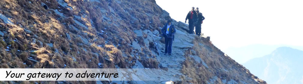
Topography
Physically, the Himalayas forms three parallel zones: the Great Himalayas, the Middle Himalayas (also known as the Inner or Lesser Himalayas), and the Sub-Himalayas, which includes the Siwalik Range and foothills and the Tarai and Duars piedmont (an area of land formed or lying at the foot of a mountain or mountain range). Each of these lateral divisions exhibits certain similar topographic features. The Great Himalayas, the highest zone, consists of a huge line of snowy peaks with an average height exceeding 6100 m (20,000 ft). The width of this zone, composed largely but not entirely of gneiss and granite, is about 24 km (about 15 mi). Spurs from the Great Himalayas project southwards into the Middle Himalayas in an irregular fashion. The Nepal and Sikkim (a state of northern India) portion of the Great Himalayas contains the greatest number of high peaks. The snow line on the southern slopes of the Great Himalayas varies from 4480 m (14,700 ft) in the eastern and central Himalayas of Nepal and Sikkim to 5180 m (17,000 ft) in the western Himalayas. To the north of the Great Himalayas are several ranges such as the Zaskar, Ladakh, and the Kailas. The Karakoram Range lies on the Tibetan side of the Great Himalayas.
The Great Himalayan region is one of the few remaining isolated and inaccessible areas in the world today. Some high valleys in the Great Himalayas are occupied by small clustered settlements. Extremely cold winters and a short growing season limit the farmers to one crop per year, most commonly potatoes or barley. The formidable mountains have limited the development of large-scale trade and commerce despite the construction of highways across the mountains linking Nepal and Pakistan to China. Older trails, which cross the mountains at high passes, also have limited trade and are open only during the summer months.
The Middle Himalayas range, which has a width of about 80 km (about 50 mi), borders the Great Himalayan range on the south. It consists principally of high ranges both within and outside of the Great Himalayan range. Some of the ranges of the Middle Himalayas are the Nag Tibba, the Dhaola Dhar, the Pir Panjal, and the Mahabharat. The Middle Himalayas possess a remarkable uniformity of height; most are between 1830 and 3050 m (between 6000 and 10,000 ft).
The Middle Himalayas region is a complex mosaic of forest-covered ranges and fertile valleys. While not as forbidding as the Great Himalayas to the north, this range has nonetheless served to isolate the valleys of the Himalayas from the plains of the Indus and Ganges rivers in Pakistan and northern India. Except for the major valley centers such as Srinagar, Kangra, and Kathmandu, and hill towns such as Simla, Mussoorie, and Darjiling (Darjeeling), the region is moderately populated. Within the Middle Himalayas the intervening mountain ranges tend to separate the densely populated valleys. The numerous gorges and rugged mountains make surface travel difficult in any direction. Few roads or transport routes exist between towns, partly because it is expensive to build them over the high, rough terrain. Only major population centers are linked by air and roads with principal cities in India and Pakistan.
The Sub-Himalayas, which is the southernmost and the lowest zone, borders the plains of North India and Pakistan. It comprises the Siwalik Range and foothills as well as the narrow piedmont plain at the base of the mountains. The width of the Sub-Himalayas gradually narrows from about 48 km (about 30 mi) in the west until it nearly disappears in Bhutan and eastern India. A characteristic feature of the Sub-Himalayas is the large number of long, flat-bottomed valleys known as duns, which are usually spindle-shaped and filled with gravelly alluvium. South of the foothills lies the Tarai and Duars plains. The southern part of the Tarai and Duars plains is heavily farmed. The northern part was forest inhabited by wild animals until about the 1950s. Most of the forests of this region have been destroyed, and much of the land has been reclaimed for agriculture.
Plant and Animal Life
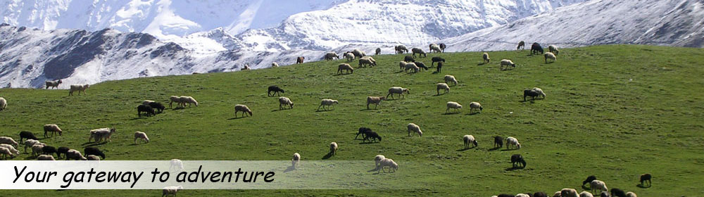
The natural vegetation is influenced by climate and elevation. Tropical, moist deciduous forest at one time covered all of the Sub-Himalayan area. With few exceptions most of this forest has been cut for commercial lumber or agricultural land. In the Middle Himalayas at elevations between 1520 and 3660 m (between 5000 and 12,000 ft) natural vegetation consists of many species of pine, oak, rhododendron, poplar, walnut, and larch. Most of this area has been deforested; forest cover remains only in inaccessible areas and on steep slopes. Below the timber line the Great Himalayas contains valuable forests of spruce, fir, cypress, juniper, and birch. Alpine vegetation occupies higher parts of the Great Himalayas just below the snow line and includes shrubs, rhododendrons, mosses, lichens, and wildflowers such as blue poppies and edelweiss. These areas are used for grazing in summer by the highland people of the Great Himalayas.
Animals such as tigers, leopards, rhinoceroses, and many varieties of deer once inhabited the forested areas of the Sub-Himalayan foothills and the Tarai plain. As a result of deforestation the habitat of most of the wildlife has been destroyed. They are now restricted to special protected areas such as the Jaldapara and Kaziranga sanctuaries in India and the Chitawan preserve in Nepal. There are few animals in the Middle Himalayas because of extensive deforestation. In the Great Himalayas musk deer, wild goats, sheep, wolves, and snow leopards are found. The existence of the Yeti has been reported by highland Sherpas in Nepal but has eluded discovery by several expeditions.
People and Economy
The population, settlement, and economic patterns within the Himalayas have been greatly influenced by the variations in topography and climate, which impose harsh living conditions and tend to restrict movement and communication. People living in remote, isolated valleys have generally preserved their cultural identities. However, improvements in transportation and communication, particularly satellite television programs from Europe and the United States, are bringing access from the outside world to remote valleys. These outside influences are affecting traditional social and cultural structure.
Nearly 40 million people inhabit the Himalayas. Generally, Hindus of Indian heritage are dominant in the Sub-Himalayas and the Middle Himalayan valleys from eastern Kashmir to Nepal. To the north Tibetan Buddhists inhabit the Great Himalayas from Ladakh to northeast India. In central Nepal, in an area between about 1830 and 2440 m (between about 6000 and 8000 ft), the Indian and Tibetan cultures have intermingled, producing a combination of Indian and Tibetan traits. The eastern Himalayas in India and nearby areas of eastern Bhutan are inhabited by animistic people whose culture is similar to those living in northern Myanmar and Yunnan province in China. People of western Kashmir are Muslims and have a culture similar to the inhabitants of Afghanistan and Iran.
The economy of the Himalayas as a whole is poor with low per capita income. Much of the Himalayas area is characterized by a very low economic growth rate combined with a high rate of population growth, which contributes to stagnation in the already low level of per capita gross national product. Most of the population is dependent on agriculture, primarily subsistence agriculture; modern industries are lacking. Mineral resources are limited. The Himalayas has major hydroelectric potential, but the development of hydroelectric resources requires outside capital investment. The skilled labor needed to organize and manage development of natural resources is also limited due to low literacy rates. Most of the Himalayan communities face malnutrition, a shortage of safe drinking water, and poor health services and education systems.
Agricultural land is concentrated in the Tarai plain and in the valleys of the Middle Himalayas. Patches of agricultural land have also been carved out in the mountainous forested areas. Rice is the principal crop in eastern Tarai and the well-watered valleys. Corn is also an important rain-fed crop on the hillsides. Other cereal crops are wheat, millet, barley, and buckwheat. Sugarcane, tea, oilseeds, and potatoes are other major crops. Food production in the Himalayas has not kept up with the population growth.
The major industries include processing food grains, making vegetable oil, refining sugar, and brewing beer. Fruit processing is also important. A wide variety of fruits are grown in each of the major zones of the Himalayas, and making fruit juices is a major industry in Nepal, Bhutan, and in the Indian Himalayas.
Since 1950 tourism has emerged as a major growth industry in the Himalayas. Nearly 1 million visitors come to the Himalayas each year for mountain trekking, wildlife viewing, and pilgrimages to major Hindu and Buddhist sacred places. The number of foreign visitors has increased in recent years, as organized treks to the icy summits of the Great Himalayas have become popular. While tourism is important to the local economy, it has had an adverse impact on regions where tourist numbers exceed the capacity of recreational areas.
Historically, all transport in the Himalayas has been by porters and pack animals. Porters and pack animals are still important, but the construction of major roads and the development of air routes have changed the traditional transportation pattern. Major urban centers such as Kathmandu, Simla, and Srinagar, as well as important tourist destinations, are served by airlines. Railways link Simla and Darjiling, but in most of the Himalayas there are no railroads. The bulk of goods from the Himalayas, as well as goods destined for places within the Himalayas, generally come to Indian railheads, located in the Tarai, by road. The pack animals and porters transport goods from road heads to the interior and back.